아세아항측 / Asia Aero Survey

본문 바로가기

팝업레이어 알림

팝업레이어 알림이 없습니다.

콘텐츠 영역

asisa gis

Flight services

AERIAL PHOTOGRAPH, AIRBORNE LIDAR, HYPERSPECTRAL

asisa gis
Share Together

Think Together

COMPANY

With accumulated in the past 20 years technology, Asia Aero Survey Co., Ltd. looks at the future of 100 years in the world spatial industry.

SERVICE

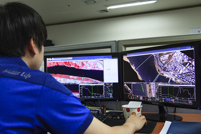
Aerial Photogragh, Hyperspectral data acguisition & analysis, R&D Project, Drone, MMS, Modeling 3D-VR, and All about GIS

SOCIAL

social

We support for the Community Chest of Korea and the Compassion International: Sponsor a Child.

What We Do

icon

Survey

The Asia Aero Survey Co., Ltd is a leading provider of Airborne Survey, precision survey and underground facility survey over 20 years. We have been maintaining the dominance in this field. We are willing to provide high-quality service for you.

icon

Spatial Imagery and Digital Mapping

We just started our business with black white colored map. Now we produce digital map.
We are trying to provide better service for 3D experience.

icon

National Infrastructure

One of the Asia Aero Survey’s vision statements is that we contribute to the national development and serve for the happiness of human society. Our concern is notational development.

icon

Social Contribution Activity

We have been supporting for Community Chest of Korea. We will not only continue to keep financial support, but also will be a good neighbor that to be one heart with